
The number of our self-guided bicycle route maps is growing, with recent additions covering Orielton Lagoon and the new Margate to Snug shared path.
The maps are available on our RidewithGPS Ambassador routes website, where we have 21 options around the state, including transport to and from Launceston and Hobart airports.
We also have a link from our website which shows where all the rides are on a map of Tasmania:
All the rides include graphs showing you ascent and distance, a photo gallery with the sites you’ll see along the way, and cautions when there are busy road crossings or on-road sections of the route.
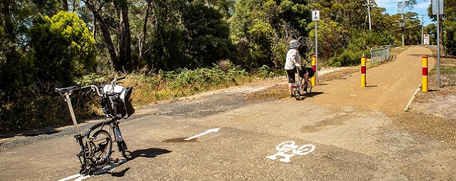
They range from easy shared path rides, to longer distances on country roads. The two most recent additions are easy rides mostly on shared paths, suitable for people wanting to get a taste of recreational riding.
You can follow the routes on your phone or download the maps for printing.
SOUTH
- Sandy Bay Riverside Roll – 21 km – along Sandy Bay Rd
- Easy Ride to MONA – 26 km – Intercity Cycleway
- Artlovers’ scenic ride to MONA – 26 km – Intercity cycleway and local roads via GASP
- City to Cascade Brewery – 9 km – Hobart Rivulet path
- Hobart Airport to the City – 21 km – via Cambridge Rd and local streets to the Tasman Bridge and Intercity cycleway.
- Ranelagh River Ride – 27 km – scenic ride on country roads through lush farmland
- Pipeline Track – 24 km – unsealed track leaving from Fern Tree, winding through bushland
- Orielton Lagoon Loop – 13 km – flat scenic ride along the Waterway Trail
- Margate–Snug Discovery – 14.5 km – shared path with connection to Dru Point
NORTH
- White Hills winery route – 35 km – quiet roads, some with marked bike lanes through farmland to Joseph Chromy vineyard.
- City sights Launceston – 16 km – bike paths and quiet streets taking in the Design Centre, City Park, river scenery.
- Longford–Cressy–Woolmers Heritage – 45 km – quiet country roads to historic convict-built estate
- Launceston Airport to City – 14.4 km – quietest route from airport to the city
NORTH-WEST
- Deloraine gourmet ride under Western Tiers – 33 km – quiet roads taking in Mole Creek, Three Willows winery, 40 Degrees South salmon farm.
- Deloraine to Westbury under Western Tiers – 35 km. Quiet country roads include historic buildings, farmland and John Temple Gallery.
- Westbury Bracknell country – 45 km – taking in rural roads and village of Bracknell.
- Devonport Discovery Tour – 23 km – coastal bike paths passing Mersey Bluff Lighthouse, Don River railway, and plenty of coastal scenery.
- Tulips on Table Cape – 27 km – September to October ride from Wynyard to Table Cape
- Devonport to Launceston – 111 km – avoid the Bass Hwy via these historic villages
- Railton–Sheffield Rail Trail – 25.7 km – follows historic tramline
CENTRAL
- Oatlands–Andover–Parattah – 66 km – via quiet country roads and rail trail