
The City of Melbourne is finalising a new Royal Park master plan that will give urgent priority to better active transport access.
A suite of new and improved trails for bike riders and pedestrians, including commuter routes and park destinations, has been proposed in the plan, which replaces the 1997 version.
Feedback on the final draft is open until 14 February 2025.
https://participate.melbourne.vic.gov.au/royal-park-master-plan-review
Royal Park, first reserved for public purposes in 1854 and now 169 hectares, is Melbourne’s largest park. It has been nibbled away at over the years as land was snatched for various non-parkland uses and never restocked. An incredible eight hectares of the park is used for car parking.
The master plan is aimed at ensuring that the park is managed and enhanced to serve future generations of Melburnians.
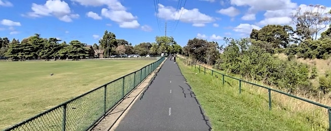
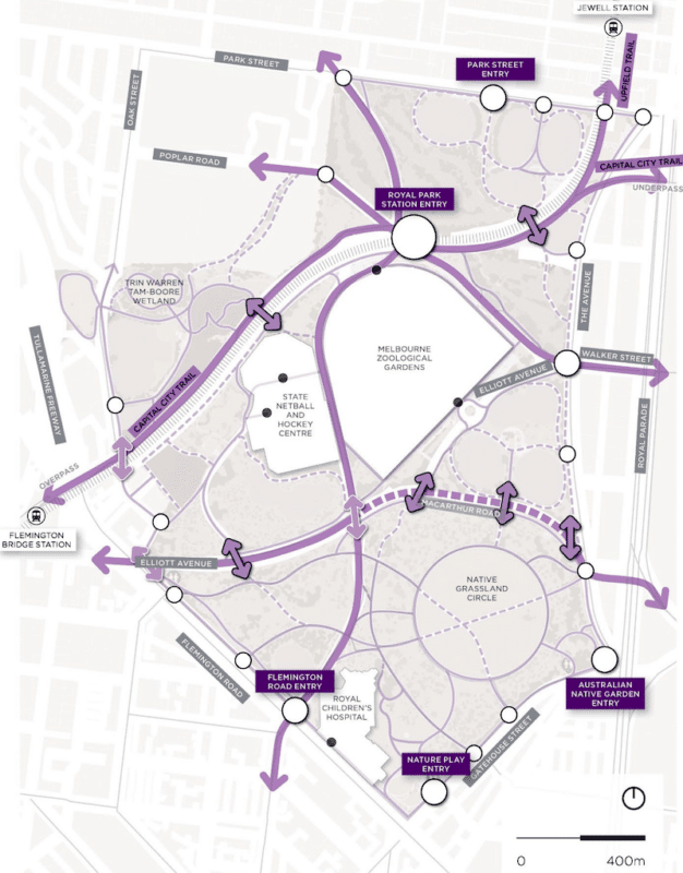
The park precinct includes important bike routes: the Capital City Tail, Upfield Trail, Flemington Road, Gatehouse Street, The Avenue, Park Street, Oak Street, Elliot Avenue, plus staff access to the Royal Children’s Hospital and destinations such as the Zoo and the State Netball and Hockey Centre.
The plan says millions of people visit the park each year, and this is expected to increase over the next two decades due to projected population growth.
"Improving access to and through the park is paramount to ensure it is a welcoming, safe and enjoyable space for all park visitors,” the plan states.
"The benefits of active transport and exercise are well-known and there is an urgent need to prioritise access improvements, particularly in relation to walkability."
The report proposes a range of interconnected paths to allow visitors to experience and move freely through the park, building upon the existing path network with a clearly articulated path hierarchy to prioritise the walking and riding experience over driving.
It envisages strategic movement corridors that form the east-west and north-south structure of the path network, including key entries and commuter routes through the park – the Capital City Trail, Upfield Trail and tram corridors.
These paths will be a minimum width of three metres and where there are congestion issues consideration will be given to separate pedestrians from other modes of active transport.
The plan also proposes major improvements to illumination of paths in the Park to a standard that supports their roles as active transport corridors while minimising environmental impact.
Or become our friend and subscribe to receive our fortnightly newsletter.