
Hobart City Council has started the approval process of its first city-wide bike plan in close to 30 years.
A draft plan was put to the council at a workshop this month and staff will now fine-tune the plan based on the feedback it’s received, including from Bicycle Network.
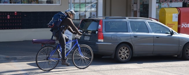
It sets itself the target of 10,000 bike trips a day by 2033, which is roughly double the current numbers.
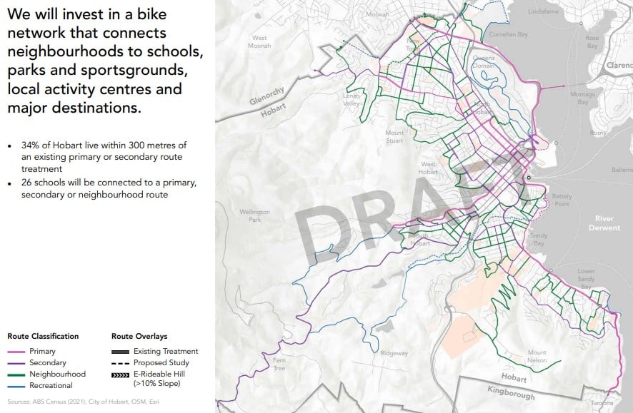
The draft plan takes the simple approach of bringing all the various strategies, local mobility plans and neighbourhood plans that the council has approved over the past 10-15 years together to create an overall network map.
But rather than mapping specific infrastructure or treatments, it uses Tasmanian Government guidance to map the primary, secondary and neighbourhood routes desirable for cycling to workplaces, schools, shops, services and recreational destinations.
More work needed
The approach caused some confusion at the council workshop where a few councillors questioned where specific projects were listed, the costs and timelines. Councillor Elliot also pointed out that the map of the city centre was missing from the plan.
The plan includes research into “quiet street” routes that can have simple treatments like lower speeds and traffic calming, as well as land gradients, shade, and propensity to ride on all routes.
And it outlines the City of Hobart’s approach to delivering new infrastructure and treatments on the selected routes:
- build what’s already been approved in the various strategies and local area plans
- improve route connections through intersections
- utilise routine asset maintenance to improve paths and line marking
- look after what’s already there to ensure it remains comfortable
- implement traffic calming, signage and crossings on neighbourhood routes
- complementary initiatives such as bike parking, education and awareness.
Bicycle Network’s preliminary feedback on the draft plan was that the network mapping sections seemed more useful for internal operations or of interest to advocates such as ourselves but wouldn’t have a great deal of meaning to most members of the public, as not all routes will receive specific infrastructure or treatments.
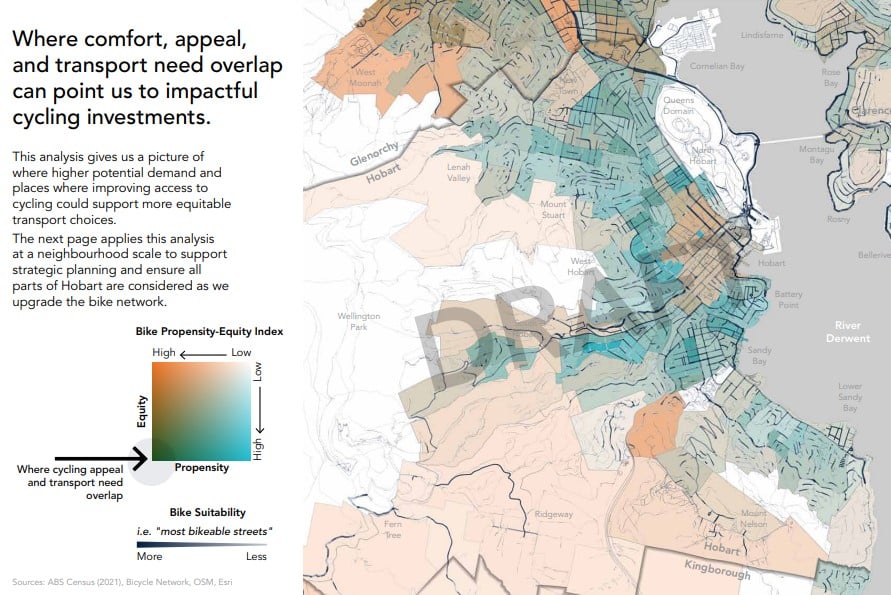
We’d like to see the council develop public-facing presentation of the maps that show people the standard of infrastructure on routes that currently exists and what the council is planning to fill the gaps in those routes and create new routes. This would be a big help to people wanting to plan cycling routes that minimise interactions with traffic and to lobby council for more comfortable infrastructure and treatments.
Christchurch in New Zealand does this well with an interactive map showing the different types of cycling treatments, bike parking and low-speed routes connecting to schools: https://ccc.govt.nz/transport/getting-around/cycling/cycling-maps.
Another map layer showing where the next improvements are being prioritised could be added for a complete view of what exists and what is planned.
Overall, the draft plan is concise, well-directed and has a good research basis. After more work is done on the mapping and prioritisation of existing approved projects, it will also be a useful asset for the broader community.
Or become our friend and subscribe to receive our fortnightly newsletter.