
A desperately needed bike route through to Ivanhoe and beyond is under consideration by Banyule City.
The middle suburbs in Melbourne’s leafy north east have never been terribly friendly to bike riders, with a dearth of good commuting routes.
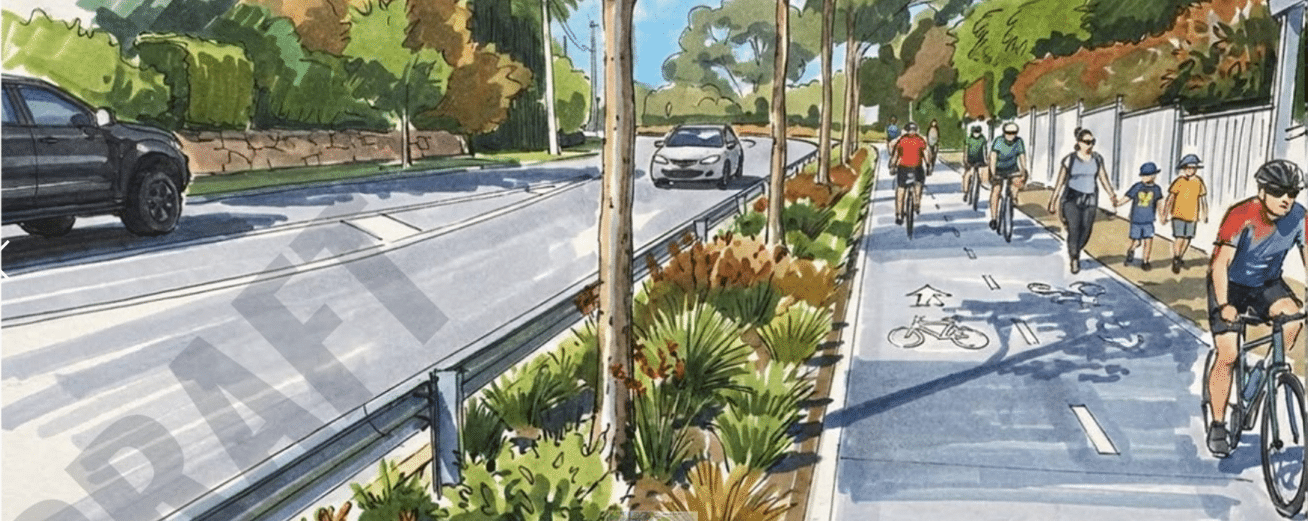
Now, the council is exploring an active transport link through Ivanhoe, more or less along the rail corridor, using a mixture of on- and off-road infrastructure through a quite difficult patch of terrain with unforgiving street connections.
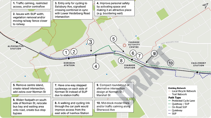
Out for public consultation is a draft report for an active transport and open space masterplan along the Hurstbridge Rail corridor, between Darebin and Ivanhoe stations. Riders can download the masterplan and contribute feedback to the council.
This section is part of a longer route proposed along the 17km rail corridor through the municipality.
Ultimately it would connect to the popular route closer to the city that runs near the rail corridor from Westgarth through Northcote, Fairfield and Alphington as far as the Darebin Creek, which is currently without a crossing.
The masterplan says the project will create a low-stress walking and cycling spine that offers a direct, legible and enjoyable alternative to car travel.
“This includes safe, separated cycling routes where traffic speed and volume require it; Quietways on calm, residential streets; and new or improved shared paths in open space or rail side land where separation between pedestrians and cyclists can be achieved.
“The corridor will support everyday trips – to the train, school, shops, parks and the creek trails – and help reduce car dependency for shorter journeys.
“This masterplan positions the corridor not only as a movement route but as a connected ribbon of public places that embeds landscape, canopy, biodiversity, and local character into the daily experience of walking and riding.”
The masterplan introduces the five precincts that make up the area between Darebin Station and Ivanhoe Station, from Rockbeare Grove to Ashby Grove:
- Area A: Salisbury Avenue
- Area B: Lower Heidelberg Road to Waterdale Road
- Area C: Ivanhoe Village Gateway
- Area D: Ivanhoe Station Precinct
- Area E: Sherwood Road
The council will review feedback during July and August with the final masterplan going before the council in late August.
Or become our friend and subscribe to receive our fortnightly newsletter.