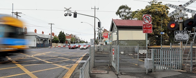
The levels crossings removals planned for Moreland Road and Bell Street in Coburg will have significant implications for major bike routes in the suburb.
The Upfield path runs along the rail corridor and will be impacted for a significant period by construction works.
On the other hand, the project could unwrap opportunities for improvement to the Upfield path, which currently struggles to cope with the demands of a busy bike commuter corridor combined with pedestrian routes to railway stations.
The government is yet to conclude its evaluation of the options for removing the crossings, and decide whether the rail goes over the roads, or under the roads
This decision has major implications for the Upfield path as rail under options require significantly more space at ground level for the trenching.
Bicycle Network was involved in the design of the under-construction new trail along the Caulfield to Dandenong rail line and can attest to the advantages of elevated rail solutions for getting improved active transport connections and urban amenity outcomes.
It is clear that a rail over option at Moreland Road and Bell Street does create much more space at ground level for walking and biking connections, and local public realm improvements.
More significantly, it is known that these precincts are built over basalt, and solid basalt is just a few metres down. Almost certainly this means that elevated rail will be the only possible solution, short of moving thousands of people for months while a longitudinal bluestone quarry is blasted through the suburb.
The other wild card—as anyone with an acute eye for levels will note—is that for the trains to get up and over Moreland Road, down to grade and then up and over Bell Street, will require climbs at gradients that are likely not achievable.
As a consequence it might make engineering and financial sense to elevate to rail and leave it elevated over Moreland, Reynard, Munro and Bell streets.
This would create even better prospects for improvements to the Upfield path, with increased area available at ground level.
One issue to be considered is the future of the existing station buildings, which fortunately are heritage protected.
However should the buildings be retained as full stations, rather than used for other functions, this will adversely constrain the opportunities for making use of the space created by elevating the rail tracks.
Why would you go to the trouble of elevating the track, creating all the extra space under it, and then squander the opportunity to use it?
No matter how the road and rail issues are resolved, the path will still have to find its way across busy roads, and how this is done will be crucial.
Bicycle Network has held discussions with the LXRA regarding the project since 2016 and they are well aware of the opportunities for active transport as part of the project.
Work will start next year and be completed in 2020.
The options are currently open for public comment. Have your say here.
This project information PDF contains more detail on the options.
Become our friend
Find out more about Bicycle Network and support us in making it easier for people to ride bikes.


