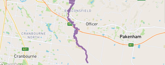
The trails and paths through the Cardinia Creek Regional Parklands in Melbourne outer south-east could be upgraded as a result of a plan to expand the park in Beaconsfield.
The 508 hectare park near Officer stretches from Beaconsfield to Clyde North.
With further development planned, the Department of Environment, Land, Water and Planning (DELWP) is seeking input from the community.
People can participate online via Engage Victoria, by filling in our survey, providing a submission or attending an online community information session.
The parklands plan will identify trails for walking, cycling and horse riding.
Long term plans for the park have always envisaged a network of recreational trails.
And planning for the new suburbs in the region has included a bike infrastructure for commuting to school and work as well as recreational paths.
Now the government is investing in the construction of new paths, a viewing area, seating and information board to revitalise an area of Cardinia Creek Parklands south of Ingles Road, Beaconsfield.
The refresh of the parklands plan will help identify the best locations for future trails, picnic facilities, access points and play areas that will be created in years to come.
This is the first stage of engagement. DELWP will consult again on the final Cardinia Creek Regional Parklands – Future Directions Plan in April 2022.
Significant parkland planning has been done through the Officer, Minta Farm, Clyde North, and Cardinia Creek South Precinct Structure Plans.
The Biodiversity Conservation Strategy for Melbourne’s Growth Corridors 2013 identified conservation values and responsibilities for the south section of the parklands (south of Princes Freeway).
The Cardinia Creek Parklands Future Directions Plan 2002 outlined a strategic framework and guidelines on parkland management. The new plan will refresh earlier work with the vision and values that are important today.
Become our friend
Find out more about Bicycle Network and support us in making it easier for people to ride bikes.


