
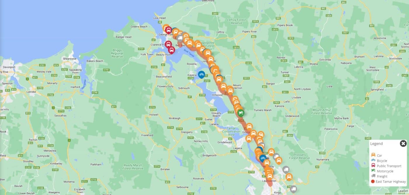
The government has embarked on its latest transport corridor study, this time for the East Tamar Highway.
It follows public consultation for the West Tamar corridor strategy which closes soon.
The government’s new approach to transport projects it so to undertake a corridor study that identifies all the major projects that need to be undertaken to improve conditions for road users, including people who walk and ride.
These studies are then used to forward plan capital spending in the short, medium and long term, out to 30 years.
Recreational road cyclists tend to use the West Tamar more than the East Tamar, however, there are a few uncomfortable points for riders which could be fixed with shoulder widening and sealing, and repositioning some roadside barriers.
There is also a need for safer transitions to and from the highway to other roads, such as the northern End of George Town Rd to John Lees Drive (heading both directions) and the southern end of George Town Rd to the city along the East Tamar Hwy and approaching the new roundabout heading south.
Off-road bike lanes
A key element for this study should be providing safer access along the corridor for people riding, walking and scooting for transport who don’t feel confident riding on the road.
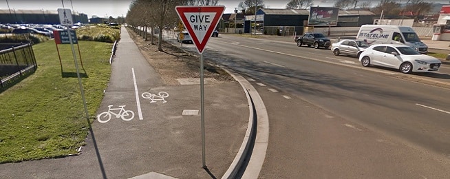
The University Trail is a shared path which starts at Lindsay Street and leads to the Newnham university campus but it is too narrow in places for multiple users. It should be widened to make it a more obvious and comfortable transport choice.
Three metres is the minimum shared path width to allow people to pass each other and there is enough space in the corridor to enable such an upgrade. In areas where space is tighter such as the steeper embankment alongside the university, then the path might have to be narrowed, but a width of a least 2.5 metres should be kept.
The path finishes just before the Plumer Street entrance to the university, but ideally should continue along the corridor up to George Town Road for existing and future residents and businesses in Alanvale and Newnham.
A useful path should be well lit so people can use it easily during darker winter days and at night, and signed with distances and directions to nearby streets and landmarks.
The George Town Road turnoff is only 7.6 km from the start of the highway in Launceston, which is an accessible distance for most people via bicycle, e-bike or e-scooter provided there was a safe path.
You can make your suggestions to the study before Monday 7 November via the online map.
Main image: Google Earth