
A possible route to extend the Snug–Margate path to Huntingfield has been released for public comment before 9 November.
A feasibility study into a route was jointly commissioned by the Tasmanian Government and Kingborough Council following the recommendation of the Channel Highway corridor study in 2020.
The feasibility study looked at several options for where a path could be built but has only offered one route for public comment. This is because it’s around half the price of other options due to land acquisition and engineering works that would have been required in other routes investigated. The other routes are briefly described on the interactive map.
While this is a great first step towards a continuous path it’s not the end of the conversation.
What’s being proposed is a compromise route that satisfies the desire for an enjoyable recreational ride but not the needs of people riding for transport. More work needs to be done to get a route in place that will help people living in the burgeoning Channel region choose active transport to access work, education, shops and services locally, and in Kingston.
You can comment on the route by sending an email to the consultants at MargateSharedPathway@stategrowth.tas.gov.au, or if you don’t want to go into detail you can rate elements of the route on the online map with either a like or dislike. https://stategrowthtas.mysocialpinpoint.com/mhsp/map#/
What’s being proposed?
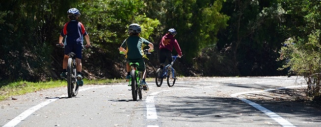
A 2.5–3 m wide gravel path with some concrete and asphalt sections that extends the current Snug–Margate path to the Huntingfield Park and Ride.
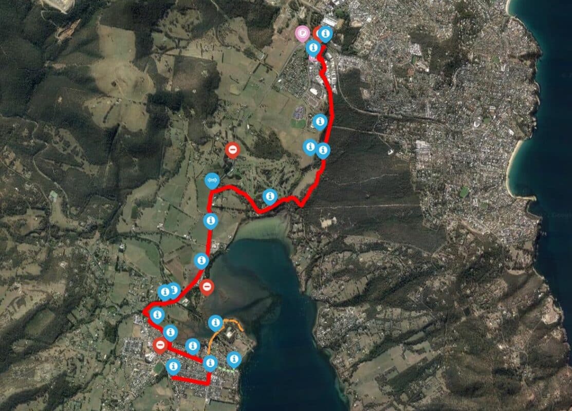
- Through Margate
The first step is to get from the end of the current path, which finishes at the Channel Museum on Channel Highway, through Margate. The study chooses a long loop through the suburb’s residential streets. This is not good news if you are passing through Margate but if you live there it means it may be easier to get on and off the path. It would mean existing footpaths would be widened to 2.5–3 metres on one side of the street.
A more direct alternative could be to remove parking on one side of Channel Highway and widen the footpath to a shared path. This would be a more direct route for people riding through the area and would provide direct access to shops and the school, reducing the need to drive to the area. It would still involve a crossing of the highway.
- Margate to Howden
The route emerges back on the Channel Highway opposite Brookfield where riders will have to cross the highway to travel down the eastern side of the Highway to Howden Road where they’ll have to cross back over the highway to travel along the edge of the golf course to the start of the Coffee Creek Trail.
The first crossing of the Channel Highway opposite Brookfield would be at road level with a refuge in the middle of the road, so not ideal for children or unconfident riders using the path. The second crossing would be a cycling and pedestrian bridge, which is the preferred option for an All Ages and Abilities path. Keeping the path on one side of the highway could be a better option to reduce the need for any crossings but would be more expensive to build.
- Howden to Huntingfield
The final leg of the route follows the current Coffee Creek Trail along the edge of the Peter Murrell Reserve, branching off at Patriarch Drive to get to the Park and Ride with another route continuing on to the underpass under Algona Road.
This is a nice part of the world for a daytime recreational ride and many people already ride down the fire trails here where the path is listed to go. However, it poses challenges for people riding for transport as it is not lit and probably wouldn’t be because of the disruption to the reserve’s natural values and would also not be sealed excluding some bikes.
An alternative would be to keep going up Channel Highway, instead of taking Howden Road, along the edge of the front of the golf course then link in to the new Huntingfield subdivision. The subdivision has a network of 3 m wide shared paths that will connect to the existing shared path on Huntingfield Avenue to the Park and Ride. This would be more direct and could be sealed and lit the whole way.
This is a feasibility study rather than the final design, and the website says they are looking for any community concerns with what’s been proposed. The path is also completely unfunded – the government and council would need a proposal with good community backing before they began to talk about funding.
Send your comments on where the path should go to be useful for all bike riders before Wednesday 9 November to MargateSharedPathway@stategrowth.tas.gov.au.