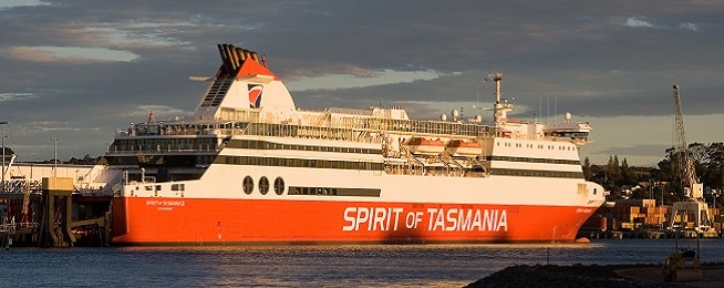
Bike riders have called for improved wayfinding to help them get to the Spirit of Tasmania terminal in Geelong.
The Spirit of Tasmania moved its Victorian dock to Corio Quay in Geelong in October last year and riders have told Bicycle Network that routes can be difficult to navigate.
Launceston rider Malcolm Cowan regularly heads to Melbourne on the ferry to visit family and set off on touring rides in other states.
A recent trip saw him trying to get to North Geelong train station at night after a day sailing.
“The first section was poorly lit and there were no signs so we kept going on the road until we could see the station.
“I’ve since found out we could have crossed over the highway earlier to a comfortable shared path but there were no signs telling us this,” Malcolm said.
Bicycle Network has written to the City of Greater Geelong calling for improved signage for riders travelling to the ferry from train stations on the Geelong line.
The City has nearly finished a masterplan for the Bay Trail that will soon go out to public consultation but it doesn't have funding yet to implement it. In the meantime, they are talking to the Department of Transport about getting temporary signage in place to help Spirit passengers.
Bicycle Network has also long called on V/Line to provide more certainty for riders to stow their bikes on regional trains.
V/Line advises people to avoid travelling with bikes during peak hours – services that arrive in Melbourne between 7am and 9.30am and leave Melbourne between 4pm and 7.30pm.
According to the current V/Line and Spirit of Tasmania timetables, this means people on the weekday overnight trip from Devonport would have to wait in Geelong for at least two hours before boarding a train to Melbourne.
Riders are advised to plan trips on weekends or during the day to avoid the hassle of peak-hour trains.
While there are fewer trains to Melbourne on weekends or at night, services stop at North Geelong and North Shore (except for the Warrnambool services), which makes the last travel leg easier.
Check the city map
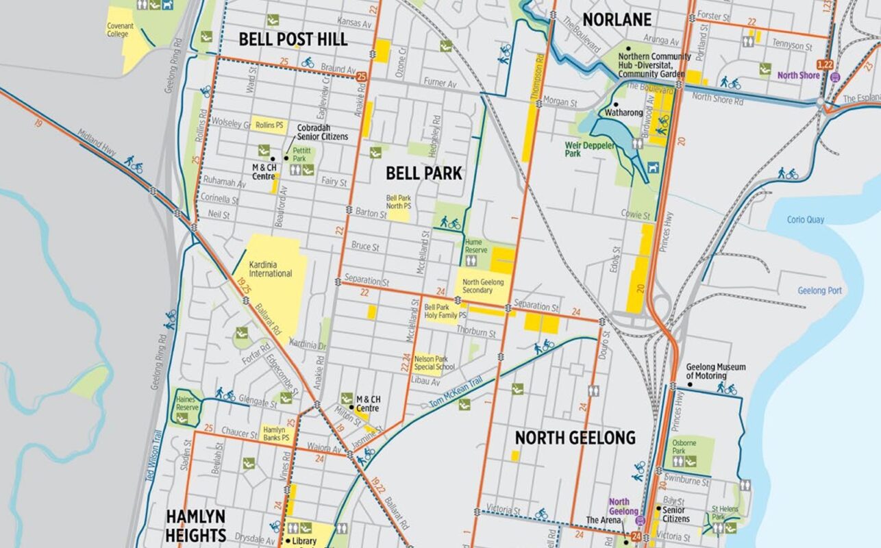
The City of Geelong has updated its active travel map for the area which shows on-road and off-road routes to get around by bicycle.
This online version can be zoomed in to show where the paths start and end and streets that connect the paths and on-road bike lanes. Riders can also download a printable version.
Google’s street view can also be used to assess whether the on-road bike lanes marked on the map are suited to rider experience levels and bike types. Some are extremely narrow and close to parked cars.
Which station to use?
The route to North Shore, which is the closest train station at 2km, is the safest by bicycle with a shared path the whole way but unfortunately this is not a major station. This means if you are travelling at peak hour some express trains will not stop and the trains that do stop may be too crowded to get a bike on.
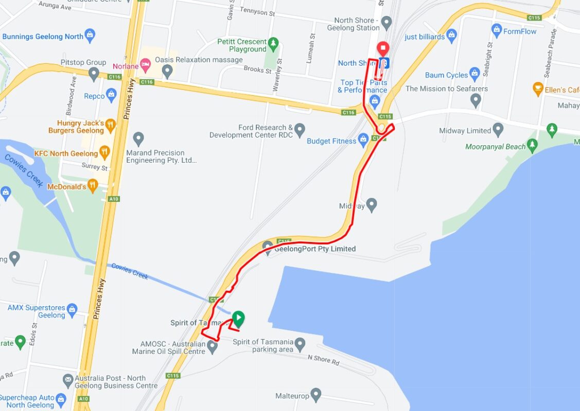
North Geelong is the next closest station, at about 2.5km from the terminal, and most trains stop here. It has a shared path most of the way but does have a short missing link in the middle of the route. Riders are required to ride on a slip road or risk the footpath (it’s illegal for people aged over 12 years to ride on the footpath in Victoria).
Riders can ask the station master to call Geelong station and request a place for them and their bike on the next train.
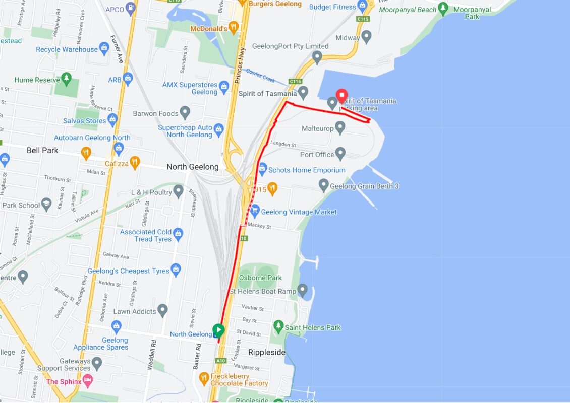
Access with bikes is more likely from Geelong Station, but it’s 5km away and more complicated to navigate than North Geelong station, though the coastal trip is more scenic.
The route to Geelong Station is mostly on shared paths, but there are two short sections on roads with no cycling infrastructure.
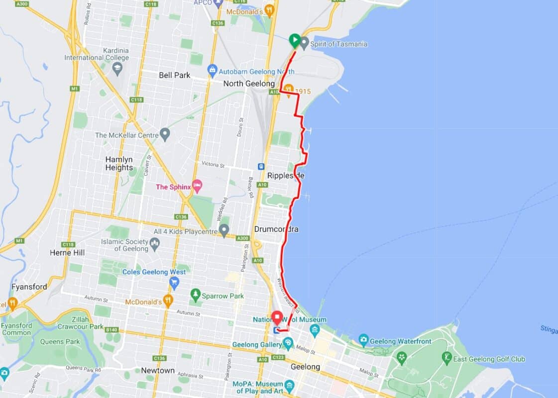
Help with your journey
Bicycle Network volunteers have mapped the routes to nearby train stations on our RidewithGPS platform to help riders plan their journey.
Main image: https://www.flickr.com/photos/nelsonminar/


