
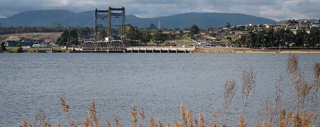
The new Bridgewater Bridge has helped spark a rethink of the waterfront and main streets through the town, with a masterplan that dramatically reimagines the area out for comment until 25 September.
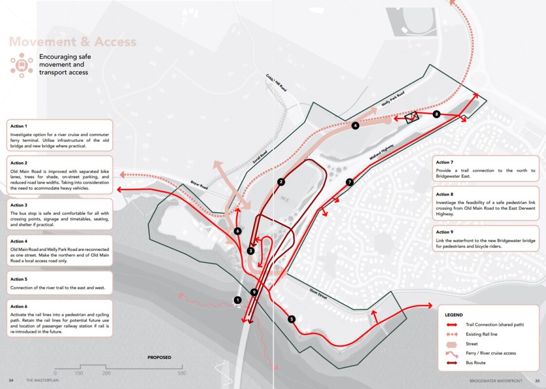
The decommissioning of the existing bridge will make way for areas of open space to be developed. The addition of a safe shared path over the new bridge has prompted thinking about pathway connections off the bridge.
Active transport is a feature of what’s being proposed, with trails along the banks as well as cycleways along Old Main Road, and public transport via buses and ferries.
The mix of transport choices would help service the larger population that would come from the masterplan’s encouragement of medium density apartment buildings along Old Main Road.
Bike lanes on Old Main Road
A 1.8-m wide bike lane is proposed on both sides of Old Main Road but it’s not clear from the two diagram options presented in the plan whether this would be separated from traffic.
The masterplan includes a picture of what an ideal cycleway should look like with a 1-metre wide physical buffer between cars but this isn’t included in the two street option diagrams.
Both street options include new tree plantings, so they could be moved to be the buffer between people cycling and scooting and moving traffic.
Waterfront trails
It sounds like shared paths are being planned for the waterfront, but again the diagrams are confusing.
The masterplan proposes a 30-m wide corridor along the riverbank and a connected network of shared walking and cycling trails so people can walk and ride along the river.
However, the diagram shows people riding on the edge of this corridor rather than through it, so that’s something that needs to be clarified.
The plan also outlines the need to connect the shared waterfront paths into the new Bridgewater Bridge shared path but it’s not clear from the masterplan exactly where these connections would be.
Public transport
A new bus stop hub for the region is envisaged for Old Main Road with bicycle facilities connecting to this and secure bike parking provided.
The plan also suggests a ferry terminal could be sited off the old bridge site’s breakwater or a pontoon terminal built, like Queensland’s floating terminals on the Brisbane River. Again, this would be connected to bike paths and provide secure bike parking.
Download the plan from brighton.tas.gov.au/community/have-your-say/ and send submissions before 25 September to development@brighton.tas.gov.au
Main image: Jimmy Harris, Flickr