
A new masterplan has been released for St Johns Park in New Town to be developed into another campus of the Royal Hobart Hospital, but there is little mention of transport links to or through the site.
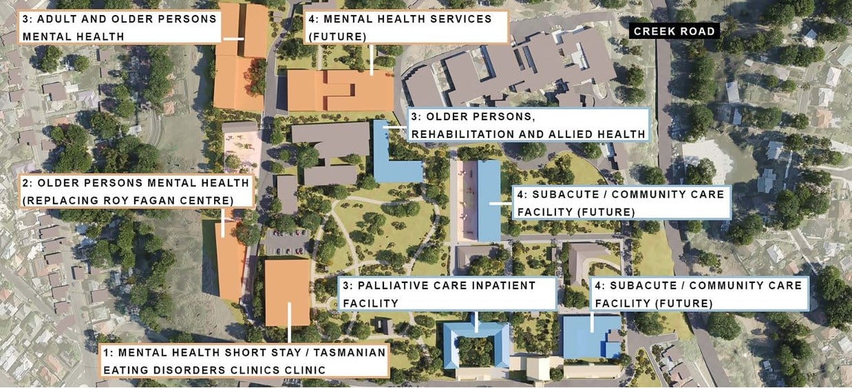
The state government is planning to redevelop the park into a health and wellbeing precinct that will include services for mental health, palliative care, rehabilitation and geriatric care.
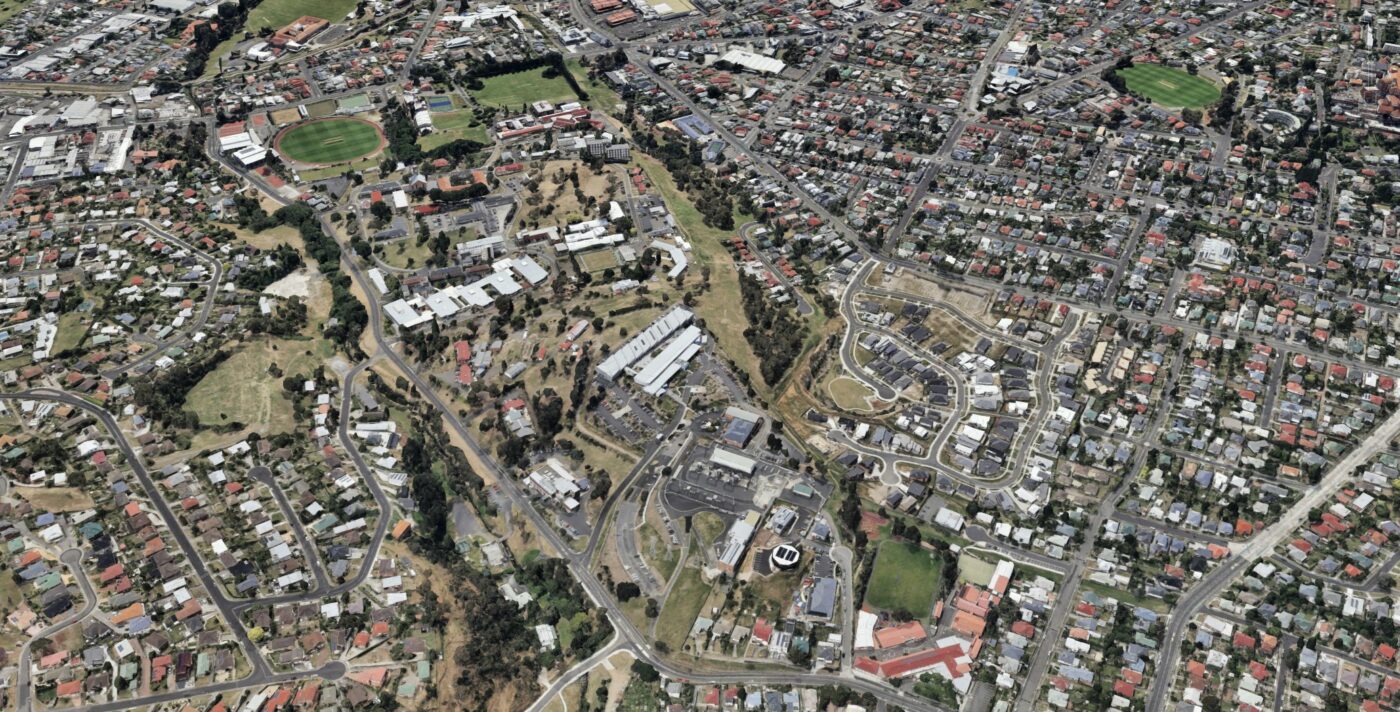
St Johns sits in the middle of a large block in New Town bordered to the north by Creek Road and south by Forster Street and New Town Primary School. On its eastern end is the Hobart High School and New Town Sports Precinct and to the west is Lenah Valley Primary School and John Turnball Park.
The City of Hobart released a masterplan for the sports precinct in 2018 that included better access into the site, and this year released a Lenah Valley mobility plan that includes a separated cycleway on Creek Road and trail linking the three schools.
All three masterplans have been developed as stand-alone documents without any real connection between the precincts.
While there are currently informal trails between the areas, gates, fences and other barriers mean these are not always usable and surfaces are poor.
The potential exists in this planning work to open up the block to make it more permeable for people riding through or to the area.
Riding to the site
If the City of Hobart builds a separated cycleway on Creek Road, it will help provide safer access to the site for more people from the north. Such access should be formalised through a crossing over Creek Road that joins with paths at the St Johns Park site.
The trail proposed between the schools in the Lenah Valley mobility plan could be incorporated into the path planning for St Johns so it is something that can be used by the local community, as well as hospital users, to move east to west.
On the southern side there is a route that already exists between St Johns Avenue and Forster Street, but it could be formalised for better navigation and access.
People can currently ride up the short extension of Valentine Street which ends at an overgrown alley with bollards at the entrance. An informal trail runs through the middle of the alley between the boundary of the school and government buildings until it gets to a gate at the school boundary. Around the gate is an asphalt path that runs to St Johns Avenue. The gate could easily be moved to open the route up for around-the-clock access.
Access along St Johns Avenue could also be improved for bike riders. Many cars use it for parking which means it can be uncomfortable to ride on at peak times. There is a footpath on one side of the street that could be widened to become a shared path or there is scope to create a gravel path between the old oak trees next to the footpath.
Riding through the site
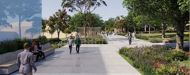
The masterplan does not address getting around the site other than providing roads and some walking paths. Active transport does not get a mention in the plan, with the focus on walking and parking.
There is scope to provide cycling and scooting access through the site for visitors and staff to get around via wider shared paths designated for riding and scooting, delineated from the walking paths.
Riding is a popular transport option for staff at the Royal Hobart Hospital in the city and the New Town site’s proximity to the Intercity Cycleway and proposed cycleways through Lenah Valley opens the possibilities for staff to ride.
You can make comment on the St Johns masterplan before 24 September via the online survey or at drop-in sessions at 188 Lenah Valley Road on Thursday 21 September, 3:30–6:30pm and Saturday 23 September, 10:30am – 1:30pm.