Clarence Council has approved a Little Howrah Beach masterplan for consultation and a final masterplan for Victoria Esplanade and Queen Street. Both include safe cycling paths.
Little Howrah Beach
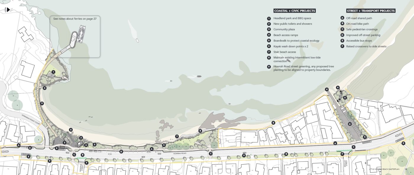
Little Howrah Beach is a missing link in the Clarence Foreshore Trail and the draft masterplan seeks to improve cycling connections to the trail through the area.
Another central component of the plan is to provide connection to a potential ferry terminal, as prioritised in the Tasmanian Government’s ferry masterplan.
The two features that most affect riders are:
- Widening the footpath along the beach side of Howrah Road to 2.5 metres between Howrah Point Court and the Foreshore Trail and a 2.5-metre-wide path from Howrah Road to the proposed ferry terminal.
- Narrowing Howrah Road from Bingley Street to Howrah Point Court
to enable the footpath widening and provide a short section of outbound
cycling lane at 1.8 metres wide.
On-street parking will be removed on Howrah Road between Bingley Street and Tranmere Road for the bike lane, however, car parking will be formalized on the other side of Howrah Road and in the gravel car parking area opposite Bingley Street.

Three new raised pedestrian crossings across Howrah Road will contribute to traffic calming of the area and the council will apply for a reduced speed limit along Howrah Road to improve safety.
The consultation period is due to open on Monday 2 December and close on Saturday 23 February 2025 via the council’s Your Say website: yoursay.ccc.tas.gov.au
Victoria Esplanade, Queen Street
The Victoria Esplanade, Queen Street masterplan went out for public comment in May 2023 and the council has now approved the final plan.
The Queen Street section of the plan includes a shared path between Bellerive Beach Park and Bellerive village/ferry terminal, which has received a $75,000 Better Active Transport grant to complete detailed designs.
The masterplan suggests a 3-metre-wide path down Queen Street, although parking removal was challenged during the consultation period and so there is a proviso in the masterplan that more consultation is needed.

The plan also includes:
- Widening of the Clarence Foreshore Trail to a consistent 3 metres between the ferry terminal and Bellerive Beach.
- Redesign of the Queen Street–Petchey Street–Cambridge Road intersection in Bellerive Village to improve connectivity for cyclists and pedestrians to the pier.
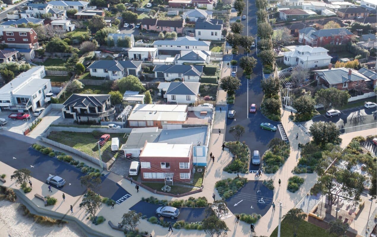
- Improving the intersections at Queen Street–Derwent Street–Victoria Esplanade near Bellerive Beach Park, with raised pedestrian crossings and promenade widening (pictured).
Or become our friend and subscribe to receive our fortnightly newsletter.


