
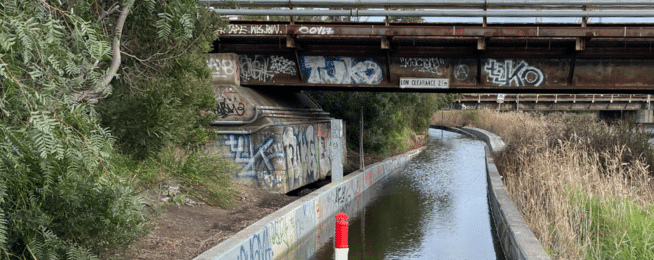
Riders on the trail along the lower Moonee Ponds Creek—and that can be a couple of thousand people on a busy commuting day—may have thought themselves in training to crew Australia’s new submarine fleet over recent weeks.
Episodic flooding of the trail from Dynon Road downstream to Footscray Road has made the trip impassable, forcing riders to detour through West Melbourne to get to Docklands.
The flooding appears related to high tides pushing water back up the creek at around the same time as commuting peak periods.
The water seems to be getting into the barrier-protected paths under the overhead bridges quicker than it can be pumped out.
Transurban, which is responsible for the maintenance of the path through this area, and the West Gate Tunnel Project (WGTP), which is undertaking major construction nearby, have attempted to stem the tide, without success.
This is a serious matter for those needing to get to and from work each day at reliable arrival times, but there is potential for it to become even more critical over the next month.
With the Footscray Road trail having to be closed periodically mostly at night and weekends, but occasionally overlapping with early commuters, additional riders could be affected.
The WGTP and Transurban are looking into what might be causing the underpasses to flood well short of full height.
While that work continues the WGTP has issued a map to guide riders through West Melbourne if the underpasses are flooded. For a downloadable version click here.
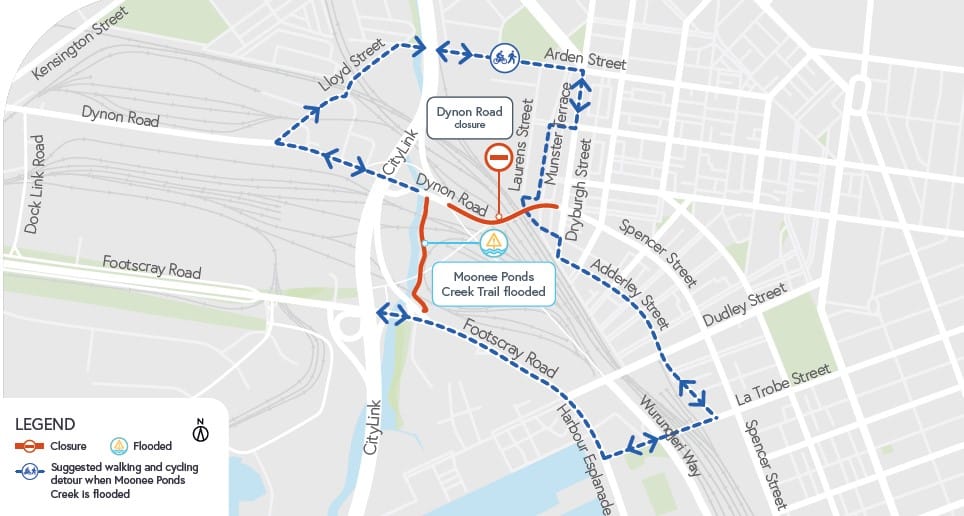
This route has been used when construction activities have closed both the Footscray Road and Moonee Ponds Creek Trails.
The WGTP is also developing signage that can be deployed at times of flood to detour riders.
The E-Gate property detour, which riders on the creek path have used in floods over the years, is no longer an option.
The underpasses would usually flood with a combination of high tide and rain in the catchment. (Rain in the catchment means rain in the catchment downstream of the Jacana Retarding Basin.)
However, the recent flood events have occurred at low river flows and at less than the highest tide levels.
Those riders who want to try their skills at predicting the flooding can find the tide tables here and the creek flow here.
Become our friend
Find out more about Bicycle Network and support us in making it easier for people to ride bikes.